Core drilling is one of the most precise and physically demanding tasks in modern construction and infrastructure work. Whether it's for installing utility lines, testing concrete strength, or creating openings for plumbing and electrical systems, the process requires more than just powerful machinery — it requires knowledge of what lies beneath the surface. This is where digital site mapping comes in.
At Core Cutting India ([email protected]), we've seen firsthand how a single overlooked utility line or unmapped rebar cluster can turn a routine drilling job into a costly, dangerous mistake. In this blog, we'll explore what digital site mapping is, why it has become a non-negotiable step before any core drilling project, the technologies involved, and how it protects your budget, timeline, and workforce.
What Is Digital Site Mapping?
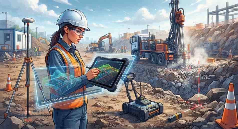
Digital site mapping is the process of using advanced scanning and imaging technologies to create an accurate, data-rich picture of a construction site before any physical work begins. Unlike traditional blueprints or manual inspections, digital mapping captures real-time, high-resolution data about what exists both above and below the surface — including embedded utilities, reinforcement bars, voids, pipes, cables, and structural elements.
This data is typically captured using tools such as Ground Penetrating Radar (GPR), 3D laser scanning, Building Information Modeling (BIM) integration, and electromagnetic locators. The output isn't just a static image — it's a detailed digital model that engineers, contractors, and drilling teams can reference to make informed decisions.
For core drilling specifically, this mapping identifies exactly where it's safe to drill, how deep a hole can go, and what obstacles might be encountered along the way.
Why Digital Site Mapping Matters Before Core Drilling
Core drilling involves cutting into concrete, masonry, or rock to create precise holes — often through walls, floors, or foundations that are already carrying live utilities or structural loads. Without knowing what's hidden inside these structures, drilling becomes a guessing game with serious consequences.
1. Preventing Utility Strikes
One of the biggest risks in any drilling project is accidentally striking a live utility line — whether it's an electrical conduit, gas pipe, water line, or fiber optic cable. A single strike can cause:
- Power outages affecting entire buildings or neighborhoods
- Gas leaks that pose fire or explosion risks
- Water damage leading to expensive repairs
- Communication network failures
Digital site mapping identifies the exact location and depth of these utilities before drilling starts, allowing teams to plan drill points that avoid them entirely.
2. Protecting Structural Integrity
Concrete structures are often reinforced with steel rebar, post-tension cables, or embedded conduits that are critical to the building's stability. Drilling directly into a post-tension cable, for example, can cause sudden and dangerous cable release, compromising the structural integrity of the entire slab.
Digital mapping tools like GPR can detect the exact position of rebar and tensioned cables, helping drilling teams choose safe entry points that don't compromise the building's load-bearing capacity.
3. Reducing Project Delays and Costs
When drilling teams strike an unexpected obstacle, work often has to stop immediately. This leads to emergency repairs, safety investigations, and schedule disruptions — all of which add unplanned costs to a project. Digital site mapping minimizes these surprises by giving teams a clear picture of what to expect, reducing downtime and helping projects stay on schedule and within budget.
4. Ensuring Worker Safety
Beyond financial and structural concerns, safety is the most important reason to invest in digital site mapping. Cutting into a live electrical line or high-pressure pipe can cause serious injury or even fatalities. By identifying hazards in advance, digital mapping significantly reduces the risk of on-site accidents, protecting both workers and the public.
5. Supporting Regulatory Compliance
Many regions now require utility verification and structural assessments before any invasive construction activity, especially in urban areas with dense underground infrastructure. Digital site mapping provides documented proof that due diligence was carried out, helping companies stay compliant with local building codes and safety regulations.
Technologies Used in Digital Site Mapping
Modern digital site mapping relies on a combination of tools and techniques, each suited to different site conditions and project requirements.
Ground Penetrating Radar (GPR)
GPR is the most widely used technology for pre-drilling surveys. It sends electromagnetic pulses into concrete or soil and measures the reflected signals to detect objects, voids, rebar, and utility lines. GPR is non-destructive, fast, and highly effective at revealing what's hidden within concrete slabs, walls, and floors.
Electromagnetic Locators (EM Locators)
EM locators are particularly useful for detecting metallic utility lines such as electrical conduits and metal pipes. They work by detecting electromagnetic fields generated by live cables, making them a reliable tool for confirming utility locations identified by GPR.
3D Laser Scanning
Laser scanning captures highly detailed, three-dimensional models of a site's surface and structural features. While it doesn't penetrate concrete, it's valuable for mapping existing structures, verifying dimensions, and integrating data into digital twins or BIM models.
Building Information Modeling (BIM) Integration
When available, existing BIM models can be layered with real-time scan data to cross-reference original design plans against actual site conditions. This is especially useful for older buildings where original blueprints may be outdated or incomplete.
Drone and Photogrammetry Mapping
For larger sites, drones equipped with high-resolution cameras can capture aerial imagery, which is then processed into detailed site maps. This helps in planning drilling locations across large industrial or infrastructure projects.
The Digital Site Mapping Process: Step by Step
At Core Cutting India, our digital site mapping process typically follows these stages:
Step 1: Site Assessment and Planning Our team reviews existing drawings, project requirements, and drilling specifications to understand what needs to be scanned and why.
Step 2: On-Site Scanning Using GPR and EM locators, our technicians scan the designated drilling areas, capturing data on embedded utilities, rebar, voids, and other obstructions.
Step 3: Data Analysis and Mapping The collected data is processed and converted into clear visual maps or reports, highlighting safe drilling zones and areas to avoid.
Step 4: Marking Safe Drill Points Based on the mapping results, safe drill points are physically marked on-site, giving drilling crews clear, actionable guidance.
Step 5: Drilling Execution With a verified map in hand, core drilling proceeds with confidence, minimizing the risk of hitting utilities or structural elements.
Step 6: Documentation and Reporting A final report is provided to the client, documenting the scanned areas, findings, and drilling recommendations — useful for compliance and future reference.
Common Applications of Digital Site Mapping Before Core Drilling
Digital site mapping is used across a wide range of projects, including:
- Commercial building renovations, where new plumbing or electrical routes need to be installed through existing concrete floors
- HVAC installations, requiring precise core holes for ductwork and piping
- Telecommunications infrastructure, where fiber optic cables need to be routed through walls or slabs
- Industrial facilities, where drilling near heavy machinery or high-voltage systems demands extra caution
- Bridge and infrastructure projects, where structural integrity assessments are critical before any invasive work
- Residential construction, particularly in older buildings where utility records may be incomplete or outdated
The Cost of Skipping Digital Site Mapping
Some contractors may view digital site mapping as an added expense that can be skipped to save time or money. However, the potential costs of skipping this step far outweigh the investment required:
- Emergency utility repairs can cost significantly more than the mapping survey itself
- Project delays from unexpected obstructions can push back entire construction timelines
- Structural damage repairs may require specialized engineering assessments and reinforcement work
- Legal liabilities and regulatory fines may apply if utility damage affects public infrastructure
- Reputational damage can affect future business opportunities for contractors and drilling companies
In nearly every case, the cost of digital site mapping is a fraction of the potential expenses tied to drilling-related accidents or damage.
Why Choose Core Cutting India for Digital Site Mapping and Core Drilling
At Core Cutting India, we combine advanced digital mapping technology with decades of hands-on drilling expertise. Our approach ensures that every project — whether a small residential job or a large industrial installation — begins with a clear understanding of what lies beneath the surface.
Our services include:
- Comprehensive GPR and EM scanning before drilling
- Detailed utility and rebar mapping reports
- Safe drill point marking and consultation
- Precision core drilling execution
- Post-project documentation for compliance and records
We understand that every site is different, and our team tailors the mapping and drilling process to match the specific requirements of your project, ensuring safety, accuracy, and efficiency at every stage.
People Also Ask
What is digital site mapping in construction? Digital site mapping is the use of scanning technologies like GPR and 3D laser scanning to create accurate digital records of what exists on and beneath a construction site, including utilities, rebar, and structural elements.
Why is site mapping important before core drilling? Site mapping helps identify hidden utilities, rebar, and structural components before drilling begins, reducing the risk of utility strikes, structural damage, and project delays.
What technology is used for digital site mapping? Common technologies include Ground Penetrating Radar (GPR), electromagnetic locators, 3D laser scanning, drone photogrammetry, and BIM integration.
How does GPR help before core drilling? GPR sends radar pulses into concrete or soil to detect embedded objects like rebar, cables, and voids, allowing teams to identify safe drilling locations without invasive testing.
What are the risks of core drilling without site mapping? Drilling without proper mapping can result in utility strikes, structural damage, safety hazards for workers, costly repairs, and significant project delays.
How much does digital site mapping cost? Costs vary depending on site size, complexity, and technology used, but the investment is typically far lower than the potential costs of utility damage or structural repairs caused by unplanned drilling incidents.
Final Thoughts
Digital site mapping has transformed the way core drilling projects are planned and executed. What was once a process reliant on guesswork and outdated blueprints is now backed by precise, real-time data that protects workers, infrastructure, and project budgets alike.
For contractors, engineers, and project managers, investing in digital site mapping before core drilling isn't just a best practice — it's a critical step toward safer, more efficient construction.
If you're planning a core drilling project and want to ensure it starts with accurate, reliable site data, reach out to Core Cutting India at [email protected]. Our team is ready to help you map, plan, and drill with confidence.